English   Română   Español   Français   Deutsch  

getamap.net

Africa

Oceania

Asia

North America

Europe

South America

Antarctica


Bras Long

(Ravine la Mare) / Reunion (general)

21°13'60" S
55°28'0" E
~452m asl
09:46 (RET - UTC/GMT+4)

Bras Long (Bras Long) is a stream (class H - Hydrographic) in Reunion (general), Reunion [ France ] (Africa) with the region font code of Americas/Western Europe. It is located at an elevation of 452 meters above sea level and its population amounts to 26,867.

Its coordinates are 21°13'60" S and 55°28'0" E in DMS (Degrees Minutes Seconds) or -21.2333 and 55.4667 (in decimal degrees). Its UTM position is CB45 and its Joint Operation Graphics reference is SF40-06.

Current local time is 09:46; the sun rises at 08:53 and sets at 21:00 local time (Indian/Reunion UTC/GMT+4). The standard time zone for Bras Long is UTC/GMT+4
In 2024 DST starts on - and ends on -.

A Stream is a body of running water moving to a lower level in a channel on land.


Country
 Advertisements:


 Advertisements:


Weather Bras Long (Cloud cover, Temperature, Wind speed and Precipitation mm probab.)

Sat


Apr 27
Clound 20-30-0-60 Mist
 
23 °C min
24 °C max
9 km/h
Thu Jan 1

Sun


Apr 28
Clound 10-20-10-60 Mist
~2 l/m2 27%
 
22 °C min
25 °C max
27 km/h
Thu Jan 1

Mon


Apr 29
Clound 20-30-0-80 Mist
~2 l/m2 27%
 
22 °C min
25 °C max
30 km/h
Thu Jan 1

Tue


Apr 30
Clound 20-50-40-80 Mist
~1 l/m2 36%
 
22 °C min
24 °C max
25 km/h
Thu Jan 1

Wed


May 1
Clound 10-30-100-100 Mist Lightning
 
22 °C min
24 °C max
21 km/h
Thu Jan 1

Thu


May 2
Clound 10-20-100-80 Mist Lightning
~1 l/m2 51%
 
22 °C min
24 °C max
16 km/h
Thu Jan 1

Weather Graph

Ravine la Mare (Reunion (general)) 7 day forecast
 

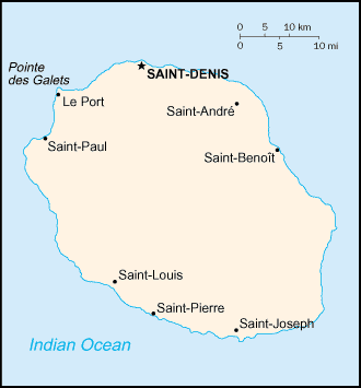
Map and Photos Bras Long


Comments

--- There are no comments yet ---


Add a new comment:


You have to log in to add a comment!


Members area


Register

Forgot password?

Reunion [ France ] (Overseas Department):
Country Flag
Country Locator

Advertisement


GPS points near Bras Long

square La Pointe (1 km)

square Ilet Ronde (1 km)

square La Riviere (1 km)

square Rivieres (1 km)


square Bras Court (2 km)

square Aloes (2 km)

square Le Ouaki (2 km)

square Le Waki (2 km)

square Le Ruisseau (3 km)

square Ruisseau (3 km)


square Mahavel (3 km)


GPS points from Reunion [ France ] (Overseas Department)

square La Pointe Reunion (general)

square Plateau Sarabe Reunion (general)

square Les Lianes Reunion (general)

square Bras Du Parc Reunion (general)

square Port Caron Reunion

square Riviere Saint Jean Reunion (general)

square Bourbon Reunion (general)

square Ravine Du Creux Saint-paul Reunion (general)


viewweather.com sv.ViewWeather.com
fr.ViewWeather.com
da.ViewWeather.com
de.ViewWeather.com
es.ViewWeather.com
www.carpati.org
www.searchromania.net
Deblocari usi
es.getamap.org
fr.getamap.org
de.getamap.org
nl.getamap.org
da.getamap.org
www.getamap.org
Links
Terms of use
Privacy policy

# 0.0930 sec 

contact AT getamap.net

© 2006 - 2024  https://www.getamap.net/